
Sensor Data Processing
Environmental telemetry is processed through a sensor fusion pipeline for signal filtering, statistical anomaly detection, clustering, and time-series analysis before summarized observations are sent to cloud AI systems.
Turning environmental signals into machine intelligence for deeper discovery.
VIR is an autonomous robotic sensing platform designed to investigate and computationally interpret environmental signals across the Yogyakarta Vortex Line.
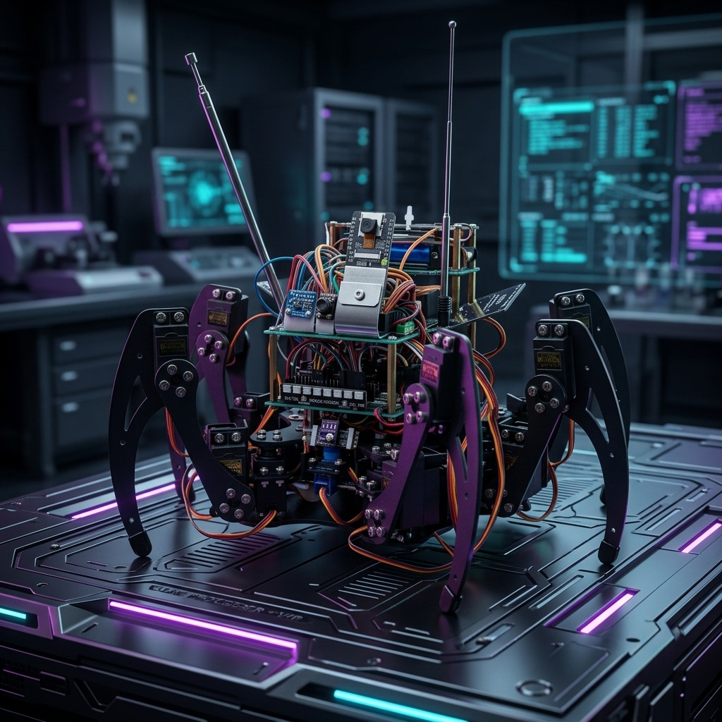
VIR integrates edge artificial intelligence, autonomous robotics, environmental sensing, and cloud-scale reasoning into a distributed observation network capable of continuously analyzing physical landscapes through machine perception.
The system collects multimodal environmental data and attempts to construct algorithmic interpretations of spatial phenomena that humans often associate with hidden patterns, anomalies, or cultural narratives.
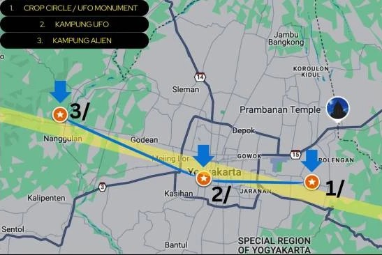
Humans have long interpreted landscapes through symbolic systems such as ley lines, geomantic alignments, and sacred geographic axes. In Yogyakarta, a local narrative known as the Yogyakarta Vortex Line connects locations associated with extraterrestrial speculation and anomalous observations.
VIR does not attempt to verify paranormal claims. Instead, it explores how machine perception systems analyze ambiguous signals within environments already embedded in human narratives.
Environmental telemetry is processed through a sensor fusion pipeline for signal filtering, statistical anomaly detection, clustering, and time-series analysis before summarized observations are sent to cloud AI systems.
Higher-level reasoning is performed through large language models accessed via API, including GPT-5, for long-term pattern analysis, contextual reasoning, hypothesis generation, and narrative synthesis.
The architecture combines real-time edge perception with large-scale reasoning models, enabling deeper interpretative capabilities without relying on the cloud for time-critical movement or perception.
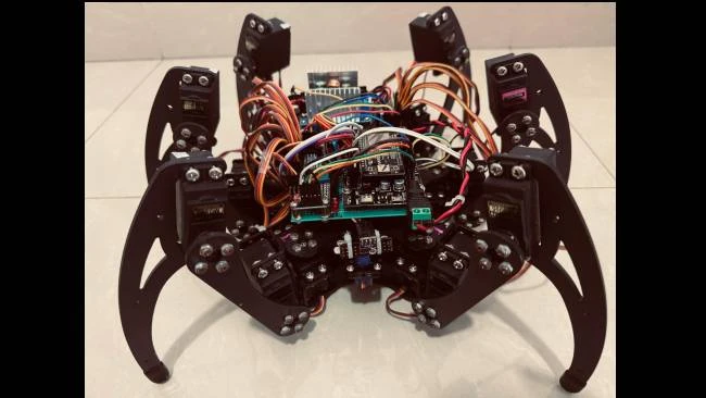
VIR is implemented as a hexapod robotic platform, allowing stable locomotion across uneven outdoor terrain. The robot features six articulated legs, each with three degrees of freedom, resulting in a total of 18 servo-driven joints.
Locomotion control is handled by a dedicated microcontroller responsible for inverse kinematics computation, gait generation, and terrain-adaptive locomotion. A Fuzzy Logic-based gait controller dynamically adjusts step height, stride length, and stabilization parameters based on terrain conditions.
VIR is not only a robotics system but also a computational experiment in how machines interpret place. By placing an AI-driven robotic observer within locations associated with cultural narratives about hidden forces, the project investigates how machines detect patterns within ambiguous environments.
Rather than confirming or rejecting the existence of a vortex phenomenon, VIR asks a deeper question: what kinds of patterns will artificial intelligence discover when it observes landscapes that humans already believe contain invisible structures?
In this sense, VIR becomes both an environmental sensing instrument and a machine ethnographer, continuously translating the physical world into computational interpretations generated by artificial intelligence.
Develop an autonomous field robotics platform capable of long-duration environmental observation.
Investigate how machine learning systems interpret ambiguous environmental signals.
Study how distributed AI systems generate patterns and hypotheses from real-world sensor data.
Explore robotics and AI as machine observers within culturally significant locations.
Transform environmental data into algorithmic narratives generated by AI models.
Use technology to support human-centered inquiry, cultural reflection, and collective imagination.

Real-time perception and environmental interpretation are performed on-device using a Raspberry Pi 5 equipped with a Hailo-10H AI accelerator.
The Vortex Line in Yogyakarta describes an east-west imaginary alignment linking several locations where recurring spatial, environmental, and observational anomalies have been documented, particularly in Berbah, Gedongkiwo, and Nanggulan.
The term emerged after observers noticed that the relative positions of these three locations resemble the configuration of Orion's Belt. This resemblance is not intended as astronomical proof, but as a cultural and symbolic reference that situates local phenomena within a broader human imagination of the cosmos.
The crop circle in Krasaan, Jogotirto, Berbah was first documented on January 23, 2011. The site later became part of a longer cultural memory through the Crop Circle/UFO Monument, inaugurated on Indonesia UFO Day, July 21, 2022.
Nanggulan in Kulon Progo is associated with oral histories of unusual celestial sightings. These narratives culminated in the designation of Kampung Alien in 2023, treating local memory and spatial experience as cultural data.
Community accounts in Gedongkiwo describe unexplained aerial phenomena, luminous objects, and unusual formations near Mount Merapi. Kampung UFO was established in 2024 as a cultural marker and educational site.
The articulation of the Vortex Line has developed through long-term initiatives led by the Indonesia Space Science Society (ISSS), in collaboration with the v.u.f.o.c Lab, Dapur AI, Indonesian National Institute of Aeronautics and Space, Indonesia UFO Network, VMARS - v.u.f.o.c Mars Analogue Research Station, International SETI Conference, and the Indonesia UFO Festival.
In the digital age, the ways humans interpret space, nature, and anomalous phenomena are increasingly shaped by technological mediation. Satellite imagery, geospatial data, social media, and digital visualization tools have transformed observation into a shared and participatory process.
The Vortex Line operates as a conceptual device that allows geographically separated sites to be read collectively. Orion's Belt is invoked not as proof, but as a symbolic and cultural reference that helps articulate how humans connect terrestrial space with cosmic imagination.
Digital tools such as participatory mapping, visual documentation, and online archiving play a central role in the project. Rather than asserting authoritative conclusions, these platforms function as shared spaces where uncertainty, curiosity, and dialogue are preserved.
Media reports indicate engagement from Sanata Dharma University, Gadjah Mada University, Indonesia Institute of the Arts, Podomoro University, and international institutions such as Nagoya University, UCLA, University of Michigan, and University of Tsukuba.
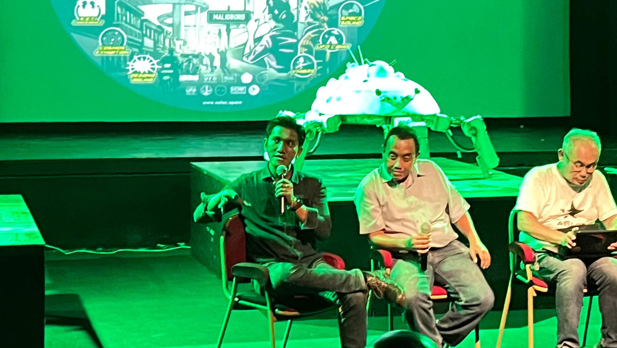
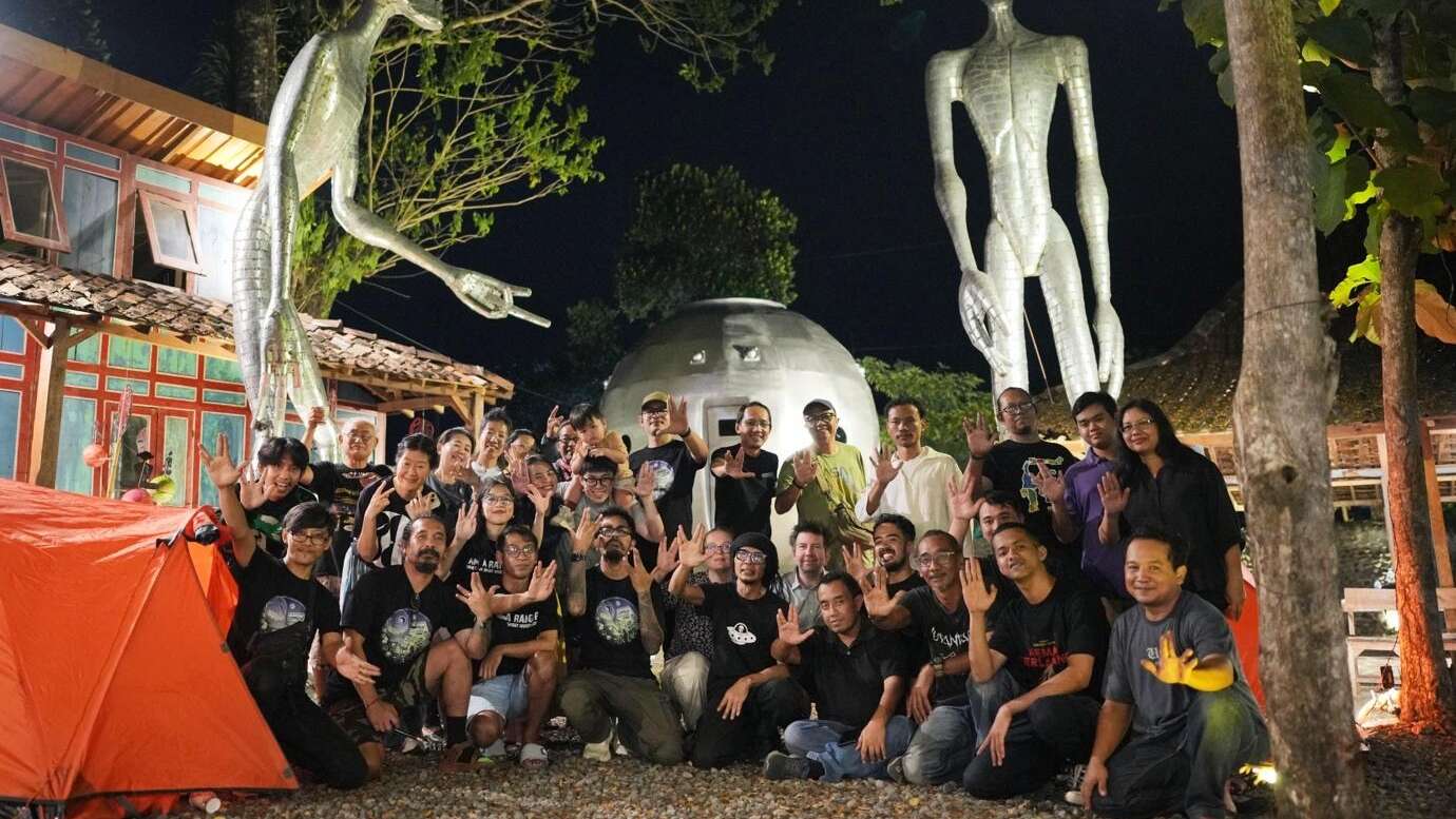
Through exhibitions, talks, workshops, and digital visualizations, research around the Vortex Line becomes an embodied and participatory experience. The project aligns with Digital Humanity by using technology to strengthen social connection, cultural diversity, and critical reflection.
Within the Digital Humanity framework, technology is valued not for efficiency alone, but for its capacity to support human-centered inquiry. Astronomy, mythology, and lived experience coexist as complementary ways of understanding space, allowing anomalies to function as sites of cultural inquiry rather than problems to be resolved.
Vortex Line and Local Cosmology in the Digital Age reflects how humans continue to make sense of space amid technological transformation. By integrating digital documentation, participatory engagement, mythology, and scientific curiosity, the Vortex Line functions as a human-centered digital humanities practice rooted in Indonesian cultural contexts.
Its significance lies not in proving anomalies, but in fostering awareness - encouraging communities to observe, document, and reflect on space as a shared cultural and cosmic relationship. In doing so, the Vortex Line aligns with the ethos of Digital Humanity.
Access the VIR platform for Anomaly Observatory Yogyakarta and explore how environmental signals become machine-readable narratives.
Login into VIR · ANOMALY OBSERVATORY YOGYAKARTA