

VIR
Vortex Intelligence Robot
Turning environmental signals into machine intelligence for deeper discovery .
VIR (Vortex Intelligence Robot) is an autonomous robotic sensing platform designed to investigate and computationally interpret environmental signals across geographically significant locations known as the Yogyakarta Vortex Line. The system integrates edge artificial intelligence, autonomous robotics, environmental sensing, and cloud-scale reasoning into a distributed observation network capable of continuously analyzing physical landscapes through machine perception.
VIR functions as a mobile AI observer that collects multimodal environmental data and attempts to construct algorithmic interpretations of spatial phenomena that humans often associate with hidden patterns, anomalies, or cultural narratives.
Background
Throughout history, humans have attempted to interpret landscapes through symbolic systems such as ley lines, geomantic alignments, and sacred geographic axes. These interpretations often emerge from patterns perceived in natural or cultural environments, where physical locations become associated with invisible forces, mythologies, or unexplained phenomena.
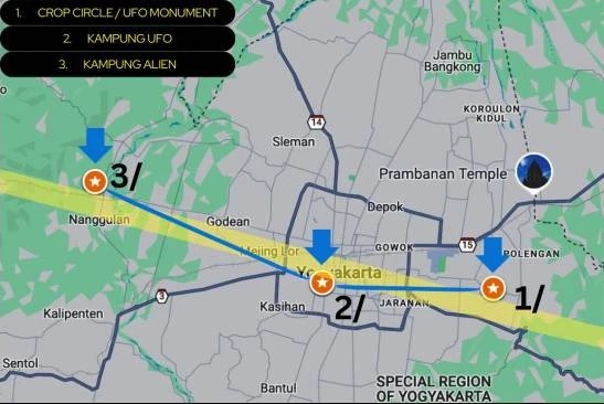
In Yogyakarta, a local narrative known as the Yogyakarta Vortex Line connects several locations associated with extraterrestrial speculation and anomalous observations, including sites such as UFO Monument, V.U.F.O.C (Yogyakarta UFO Community), and Kampung Alien.
VIR was developed as an experimental system that investigates how artificial intelligence might interpret such locations without prior cultural assumptions. Rather than attempting to verify paranormal claims, the project explores how machine perception systems analyze ambiguous signals within environments already embedded in human narratives.
By placing an autonomous AI-driven robot within these locations, VIR transforms the landscape into a computational observation field, where environmental signals, visual patterns, and spatial metadata are continuously recorded and analyzed.
Project Objectives
The primary objective of VIR is to explore the intersection between AI perception, physical landscapes, and human cultural narratives.
More specifically, the project aims to:
Autonomous Field Robotics
Develop an autonomous field robotics platform capable of long-duration environmental observation.
Machine Learning Interpretation
Investigate how machine learning systems interpret ambiguous environmental signals.
Distributed AI Analysis
Study how distributed AI systems generate patterns and hypotheses from real-world sensor data.
Robotic Environmental Observation
Explore how robotics and artificial intelligence can function as machine observers within culturally significant locations.
AI Narrative Generation
Transform environmental data into algorithmic narratives generated by AI models.
Through this approach, VIR becomes both a technological experiment and an artistic investigation into how machines construct meaning from physical environments.
Technology Stack
VIR is built as a hybrid edge–cloud artificial intelligence architecture that distributes computational tasks across multiple hardware layers.
Edge AI Perception
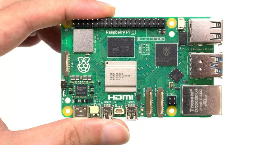
Real-time perception and environmental interpretation are performed on-device using a Raspberry Pi 5 equipped with a Hailo-10H AI accelerator (Hailo AI Hat).
The edge AI layer runs several neural network models, including:
- Vision-Language Models (Qwen2.5-VL-7B-Instruct) for multimodal scene interpretation and contextual visual reasoning.
- EfficientFormer-L1 for low-latency image classification and environmental anomaly detection.
- Computer vision pipelines implemented using OpenCV.
This edge inference architecture allows the robot to perform real-time visual understanding without relying on cloud-based inference for time-critical tasks.
The AI acceleration stack is implemented using the Hailo Developer Zone ecosystem, including:
- Hailo Dataflow Compiler
- Hailo Runtime (HailoRT)
- Hailo Model Zoo
- Hailo TAPPAS pipeline framework
These tools enable optimized deployment of deep neural networks on the Hailo tensor processing architecture.
Sensor Data Processing
Environmental telemetry collected by the robot is processed using a sensor fusion pipeline built with scientific computing frameworks. These tools are used to perform:
- signal filtering
- statistical anomaly detection
- clustering of environmental signals
- time-series analysis of sensor observations
Classical machine learning methods are used to preprocess sensor data before transmitting summarized observations to cloud-based AI systems.
Cloud Intelligence Layer
Higher-level reasoning and narrative synthesis are performed through large language models accessed via API, including GPT-5.
The cloud AI layer performs:
- long-term pattern analysis across sensor observations
- contextual reasoning about environmental anomalies
- hypothesis generation based on collected data
- narrative synthesis describing the robot’s observations
This architecture allows the system to combine edge-level perception with large-scale reasoning models, enabling deeper interpretative capabilities.
Robotics Architecture
VIR is implemented as a hexapod robotic platform, allowing stable locomotion across uneven outdoor terrain.
The robot features six articulated legs, each with three degrees of freedom, resulting in a total of 18 servo-driven joints.
Locomotion control is handled by a dedicated microcontroller responsible for:
- inverse kinematics computation
- gait generation
- terrain-adaptive locomotion
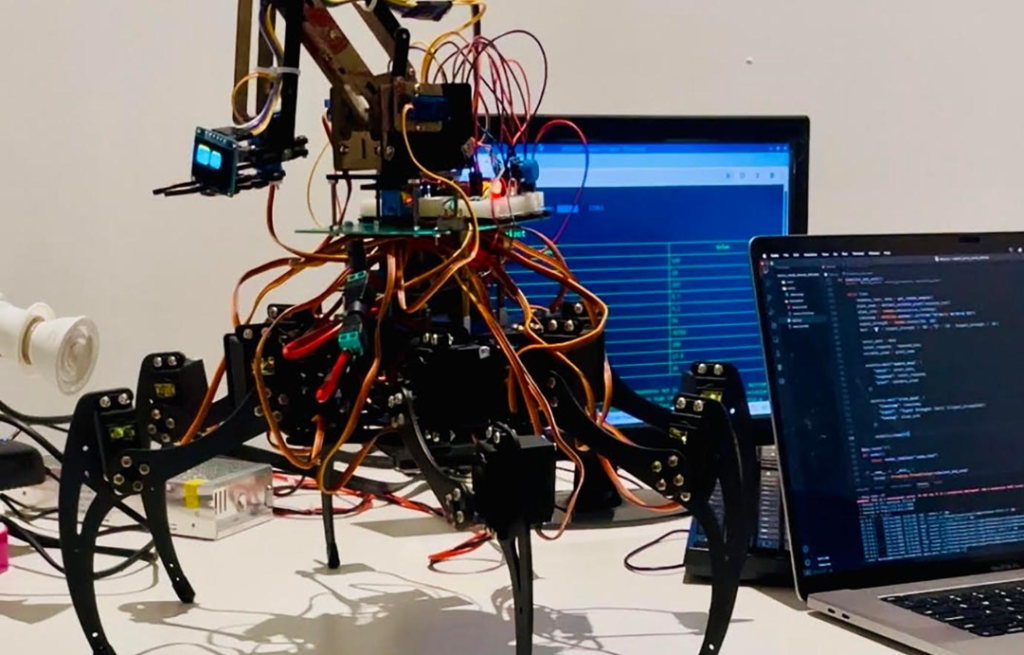
To ensure stability across irregular surfaces, the robot implements a Fuzzy Logic–based gait controller, which dynamically adjusts step height, stride length, and stabilization parameters based on terrain conditions.
Separating locomotion control from the main AI system ensures deterministic real-time movement while AI perception and analysis run asynchronously.
Conceptual Framework
VIR is not only a robotics system but also a computational experiment in machine interpretation of place.
By placing an AI-driven robotic observer within locations associated with cultural narratives about hidden forces, the project investigates how machines detect patterns within ambiguous environments.
Rather than confirming or rejecting the existence of a vortex phenomenon, VIR examines a deeper question:
What kinds of patterns will artificial intelligence discover when it observes landscapes that humans already believe contain invisible structures?
In this sense, VIR becomes both an environmental sensing instrument and a machine ethnographer, continuously translating the physical world into computational interpretations generated by artificial intelligence.
Vortex Line and Local Cosmology in the Digital Age
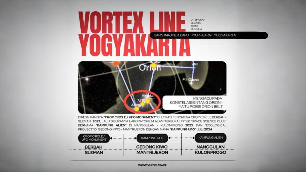
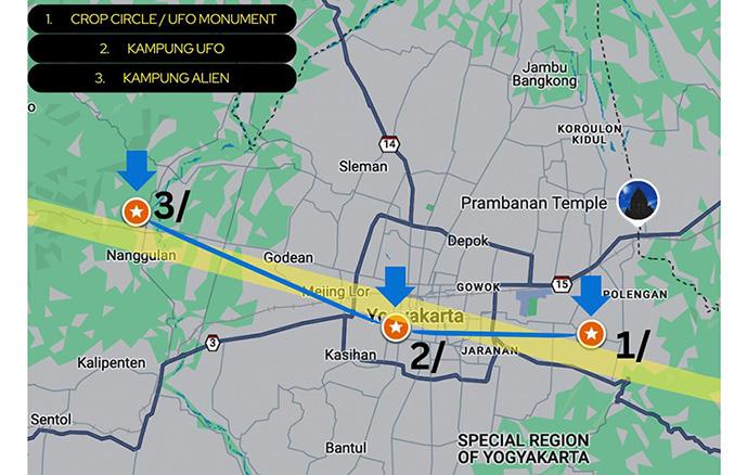
The Vortex Line in Yogyakarta describes an east–west imaginary alignment linking several locations where recurring spatial, environmental, and observational anomalies have been documented, particularly in Berbah, Gedongkiwo, and Nanggulan in the Yogyakarta region of Indonesia. The term “Vortex Line” emerged after observers noticed that the relative positions of these three locations resemble the configuration of Orion’s Belt—a well-known group of three bright stars within the Orion constellation, visible from both hemispheres and historically used across cultures to navigate and interpret the night sky. This resemblance is not intended as astronomical proof or deterministic causality. Instead, Orion’s Belt serves as a cultural and symbolic reference that allows these sites to be interpreted collectively, situating local phenomena within a broader human imagination of the cosmos.
The articulation of the Vortex Line has developed through long-term initiatives led by the Indonesia Space Science Society (ISSS), in collaboration with the v.u.f.o.c Lab, Dapur AI, Indonesian National Institute of Aeronautics and Space, Indonesia UFO Network, VMARS – v.u.f.o.c Mars Analogue Research Station, International SETI Conference, and the Indonesia UFO Festival. Each site connected by the Vortex Line carries distinct local narratives: the crop circle site in Berbah, first documented in 2011 and later marked by a UFO Monument inaugurated on Indonesia UFO Day in 2022; Kampung Alien in Nanggulan, grounded in long-standing oral histories of unusual celestial sightings (2023); and Kampung UFO in Gedongkiwo, shaped by community accounts of unexplained aerial phenomena (2024). Viewed together, these locations form a cultural constellation within the landscape of Yogyakarta.
The Vortex Line Project also explores technological approaches through VIR (Vortex Intelligence Robot), an AI-integrated robotic system designed to analyze environmental data and patterns associated with natural anomalies. By connecting mythology, spatial observation, and scientific data, the project explores how digital technologies can support new ways of interpreting natural phenomena while fostering public awareness and strengthening environmental monitoring and disaster mitigation.
Keywords: Indonesia Space Science Society; Vortex Line Yogyakarta; art–science; local cosmology; digital humanities; Indonesia UFO Festival; Vortex Intelligence Robot; VIR; Dapur AI; VMARS
Introduction
In the digital age, the ways humans interpret space, nature, and anomalous phenomena are increasingly shaped by technological mediation. Satellite imagery, geospatial data, social media, and digital visualization tools have transformed observation into a shared and participatory process. At the same time, this expansion of digital observation often privileges dominant scientific narratives, while marginalizing culturally embedded ways of understanding space.
The Vortex Line in Yogyakarta emerges at this intersection. The term “Vortex Line” refers to an east–west imaginary alignment connecting several locations—most notably Berbah, Gedongkiwo, and Nanggulan—where recurring environmental patterns and anomalous observations have been reported over time. The designation does not imply the existence of a literal vortex or a singular causal mechanism. Instead, it operates as a conceptual device that allows these geographically separated sites to be read collectively.
This collective reading is informed by an observed spatial resemblance between the three sites and Orion’s Belt, a widely recognized stellar formation composed of three aligned stars. Across many cultures, Orion has functioned as a reference point in navigating the night sky and constructing cosmological narratives. In the case of the Vortex Line, Orion’s Belt is not invoked as astronomical proof, but as a symbolic and cultural reference that helps articulate how humans connect terrestrial space with cosmic imagination.
Sites of the Vortex Line :
Berbah: Crop Circle and UFO Monument
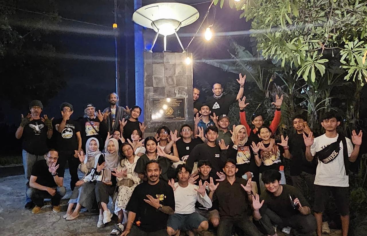
One of the earliest phenomena associated with the Vortex Line is the appearance of a crop circle in the rice fields of Krasaan, Jogotirto, Berbah (Sleman) on January 23, 2011. The formation drew public attention due to its unusual circular pattern and the absence of a clear explanation. Over time, the site became a focal point for community discussion and documentation.
In collaboration with local residents and cultural institutions, a Crop Circle/UFO Monument was later established at the site. The monument was inaugurated on Indonesia UFO Day, July 21, 2022, marking the event as part of a longer cultural memory rather than a singular incident.
Nanggulan: Kampung Alien
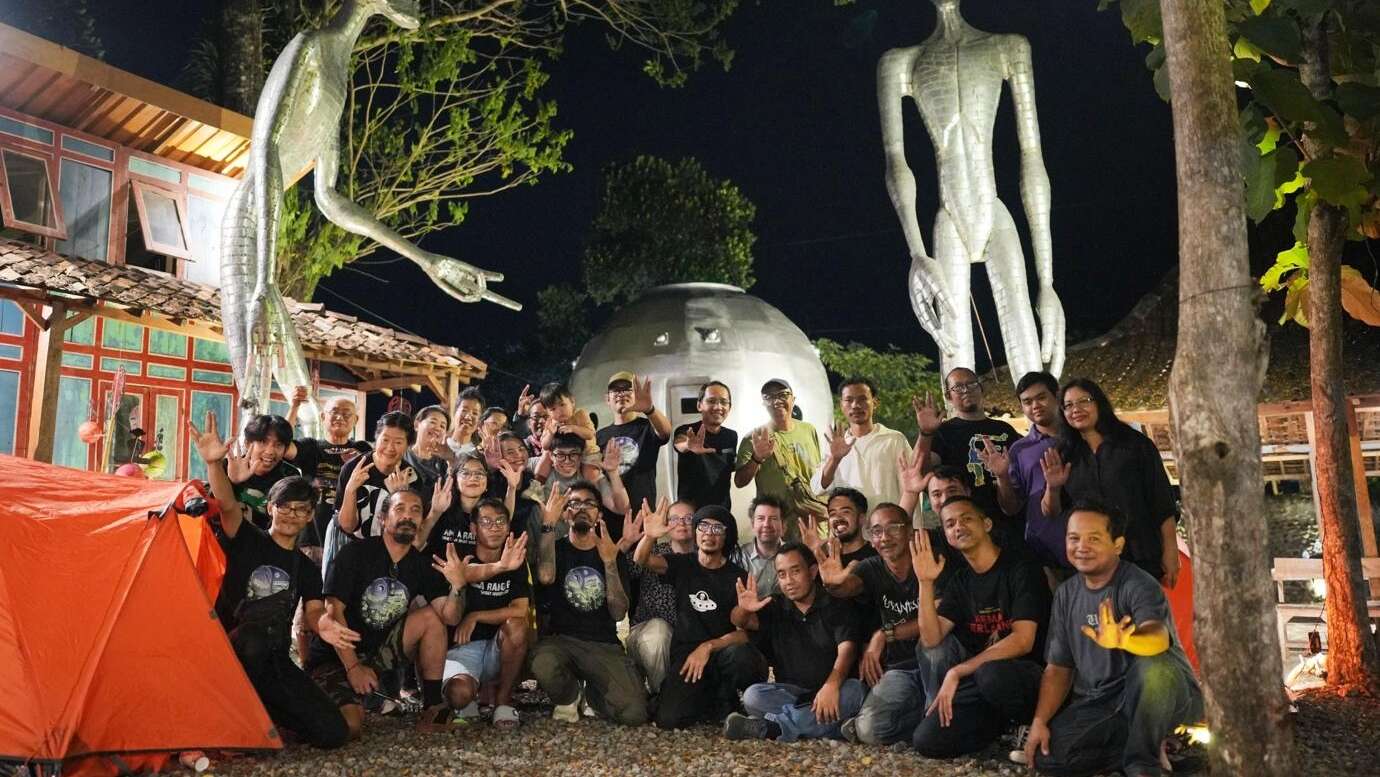
The Nanggulan area in Kulon Progo has long been associated with oral histories of unusual celestial sightings. These narratives culminated in the designation of Kampung Alien, inaugurated on Indonesia UFO Day in 2023. Here, local memory and spatial experience are treated as valuable cultural data, contributing to the broader reading of the Vortex Line.
Gedongkiwo: Kampung UFO
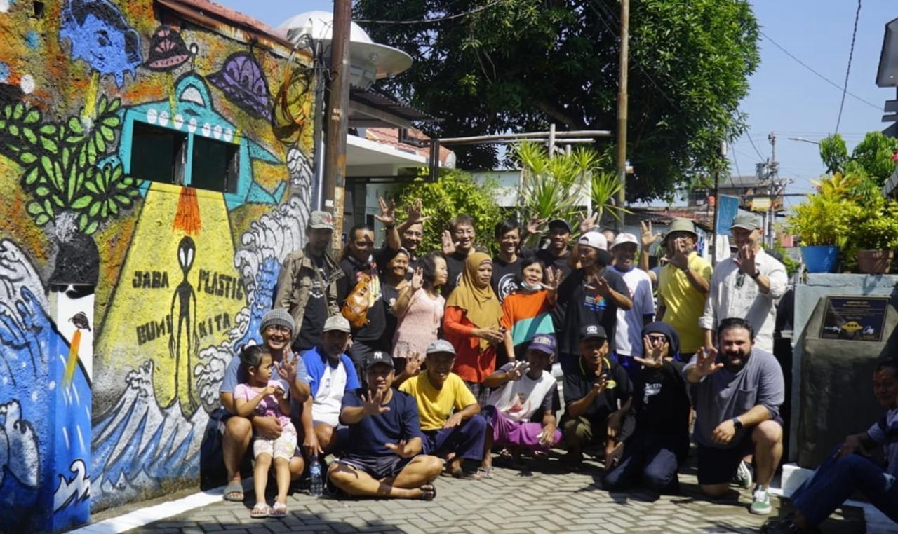
In Gedongkiwo, Yogyakarta City, various community accounts describe sightings of unexplained aerial phenomena, including luminous objects and unusual formations near Mount Merapi. These narratives led to the establishment of Kampung UFO as a cultural marker and educational site (2024). Rather than validating or dismissing these accounts, the initiative provides a space where observation, storytelling, and scientific curiosity intersect.
Digital Practices and Participatory Knowledge
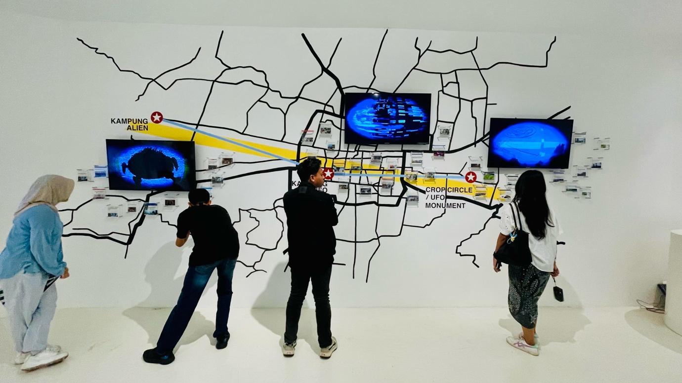
The articulation of the Vortex Line developed through collaborative practices initiated by the Indonesia Space Science Society (ISSS), operating at the intersection of space science, art, and public education. Digital tools—such as participatory mapping, visual documentation, and online archiving—play a central role in this process.
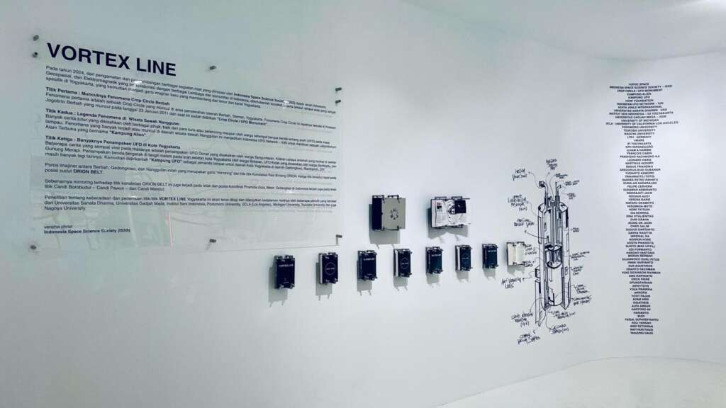
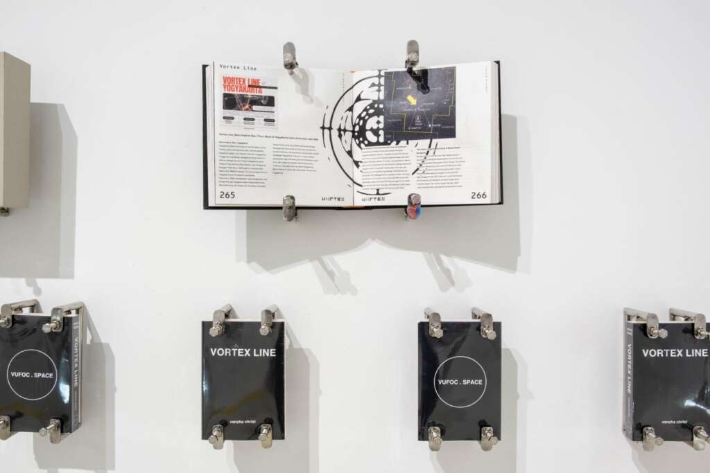
Rather than asserting authoritative conclusions, these digital platforms function as shared spaces where uncertainty, curiosity, and dialogue are preserved. Contributions from scientists, artists, researchers, and local communities are documented and contextualized, allowing knowledge to remain open-ended and collectively produced.
Institutional and Academic Collaboration
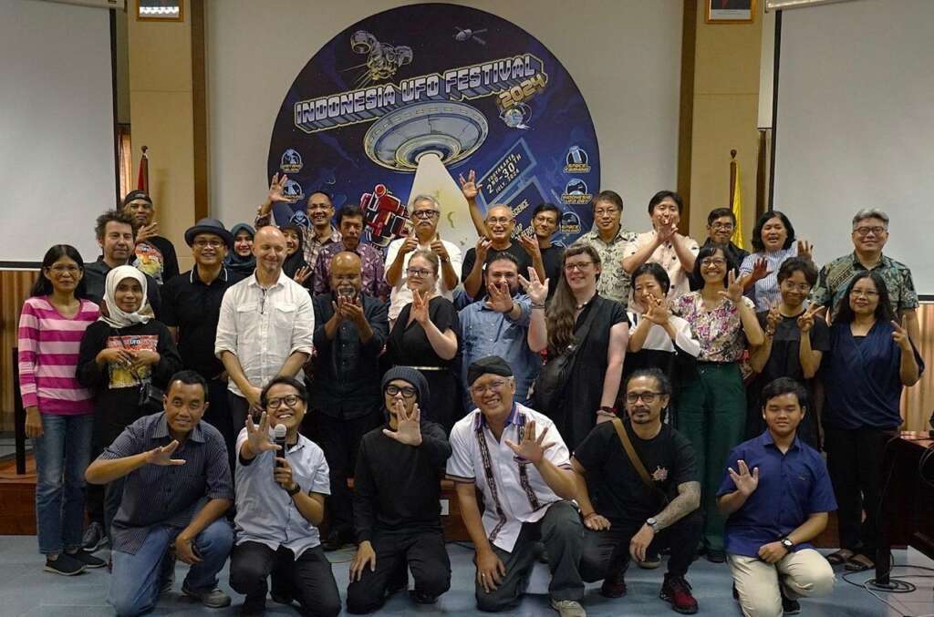
Media reports indicate that research related to the Vortex Line has attracted engagement from a range of academic institutions. These include Sanata Dharma University, Gadjah Mada University, Indonesia Institute of the Arts, and Podomoro University, as well as international institutions such as the Nagoya University, University of California Los Angeles (UCLA), University of Michigan, and University of Tsukuba. These collaborations highlight the transdisciplinary nature of the project, spanning cultural studies, science, and artistic research.
Festival as a Digital Humanities Interface
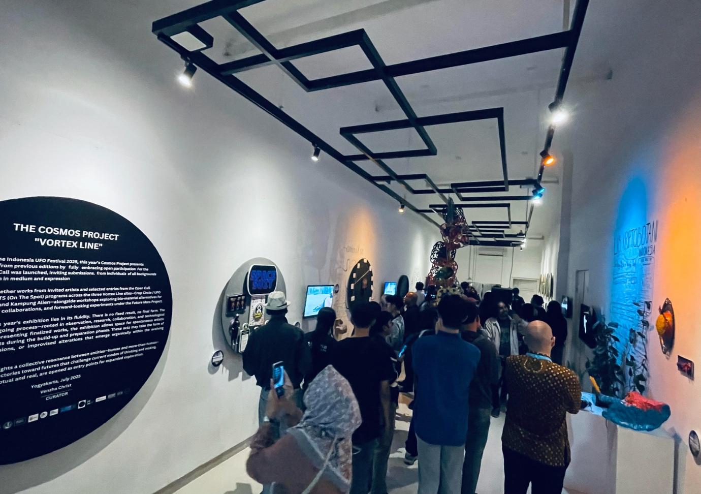
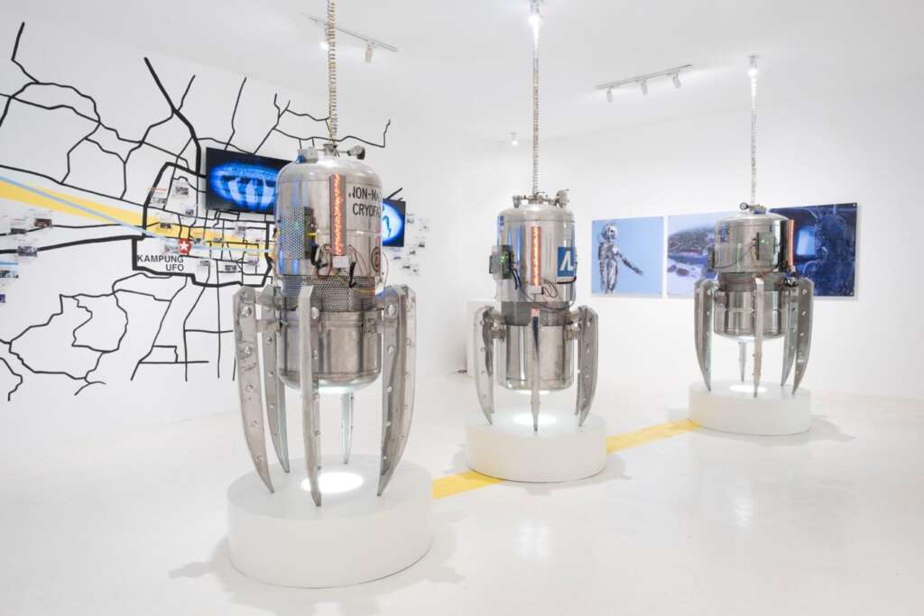
The Indonesia UFO Festival serves as a key public interface for the Vortex Line. Through exhibitions, talks, workshops, and digital visualizations, the festival translates research into embodied and participatory experiences. The Vortex Line has been foregrounded as a thematic focus, allowing visitors to engage with diagrams, narratives, and speculative interpretations rather than fixed conclusions.
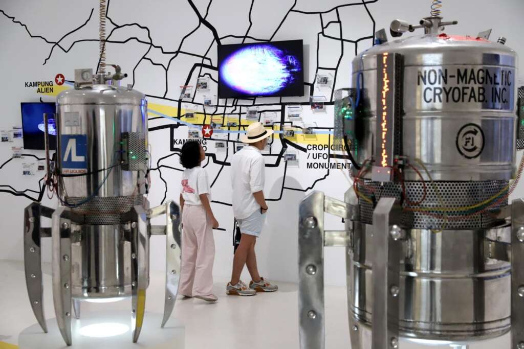
This performative and dialogical approach aligns closely with the principles of Digital Humanity, where technology is employed to strengthen social connection, cultural diversity, and critical reflection.
Space, Mythology, and Digital Humanity
Within the Digital Humanity framework, technology is valued not for efficiency alone, but for its capacity to support human-centered inquiry. The Vortex Line exemplifies this by using digital tools as a translation layer—connecting scientific observation with local cosmology and mythology.
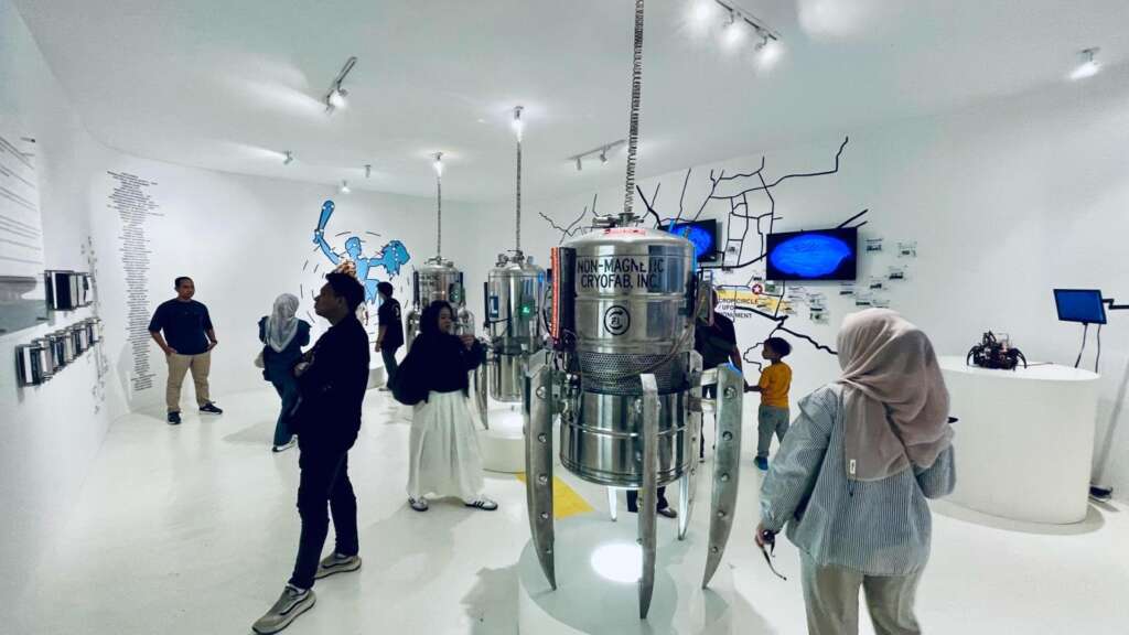
Rather than privileging a single explanatory model, the project embraces plurality. Astronomy, mythology, and lived experience coexist as complementary ways of understanding space, allowing anomalies to function as sites of cultural inquiry rather than problems to be resolved.
Conclusion
Vortex Line and Local Cosmology in the Digital Age reflects how humans continue to make sense of space amid technological transformation. By integrating digital documentation, participatory engagement, mythology, and scientific curiosity, the Vortex Line functions as a human-centered digital humanities practice rooted in Indonesian cultural contexts.
Its significance lies not in proving anomalies, but in fostering awareness—encouraging communities to observe, document, and reflect on space as a shared cultural and cosmic relationship. In doing so, the Vortex Line aligns with the ethos of Digital Humanity: technology in service of understanding, care, and collective imagination.